Shoreline changes quantifcation using satellite images
Started in 2021
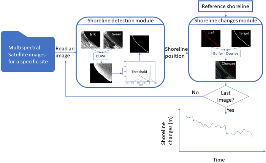
This project focuses on developing an end-to-end, fully automated framework for detecting and analyzing shoreline change from multispectal satellite imageries. By leveraging image processing techniques, the approach eliminates the need for manually drawn transects, enabling a scalable and objective method for quantifying shoreline change. The framework has been applied to multiple beaches along Lake Michigan to assess the impacts of recent, record-breaking water level rises. In addition to quantifying shoreline retreat, the project investigates the spatial variability in erosion patterns and explores potential causative factors such as geomorphology, exposure, and wave energy dynamics (Abdelhady et al., 2022).
The model was used to quantify shoreline recession at eleven beaches around Lake Michigan during a record-setting water level increase between 2013 and 2020. Shoreline changes during this period ranged from 20 m to 62 m, corresponding to 52–95 % of the initial beach widths. Average estimated shoreline erosion across all beaches varied from 1 % to 75 % of the observed changes, with the remainder attributed to inundation (Abdelhady et al., 2025).

